AirTech Portal
Every camera, survey and flight on your project, in one place.
The platform behind our monitoring work. Time-lapse, drone surveys, 3D models and live cameras under one login, built for construction documentation.
The record belongs to the project, not to a supplier.
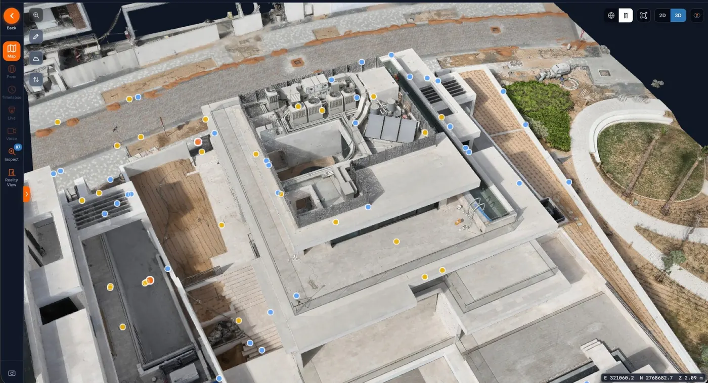
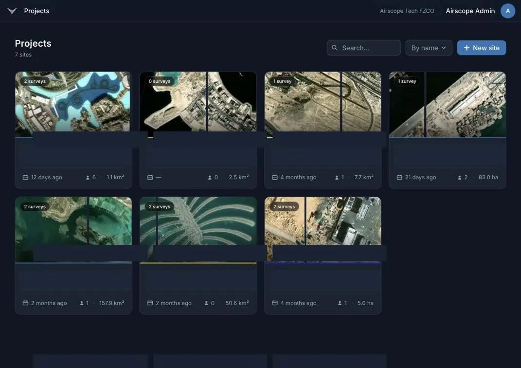
On most builds the imagery is scattered: photos on phones, survey data on a consultant's drive, time-lapse with whoever supplied the camera. In the Portal, every capture we make lands on one map, registered to the same plan and organised by date, and stays there for the life of the contract.
Features
Features
Inside the Portal
One login, every way of looking at the site.
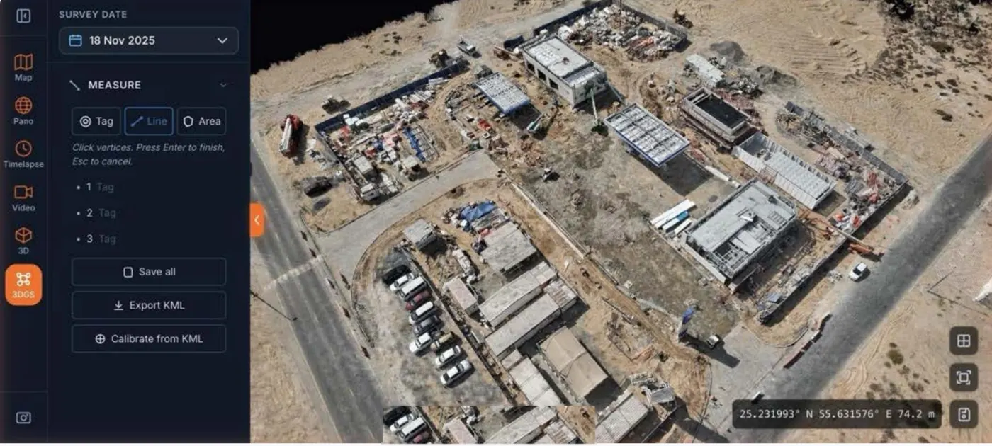
The whole site from above, after every flight.
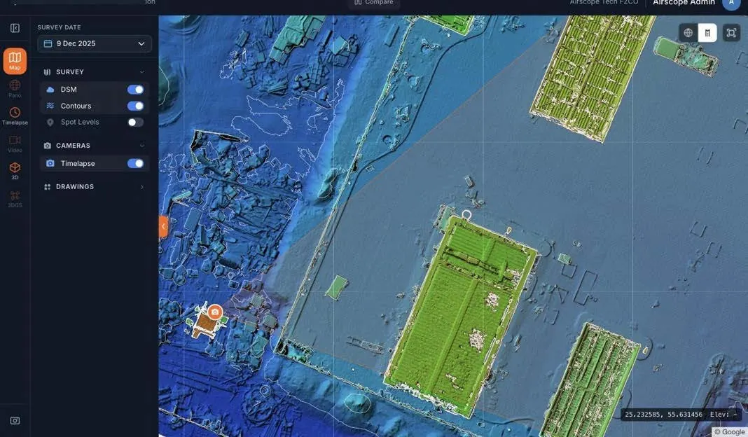
Each survey becomes an orthomosaic and surface model on one map, with 360 panoramas and live cameras pinned where they stand.
- Distance, area, height and volume in a click
- Panoramas and cameras placed on the map
- Every survey date kept, never overwritten
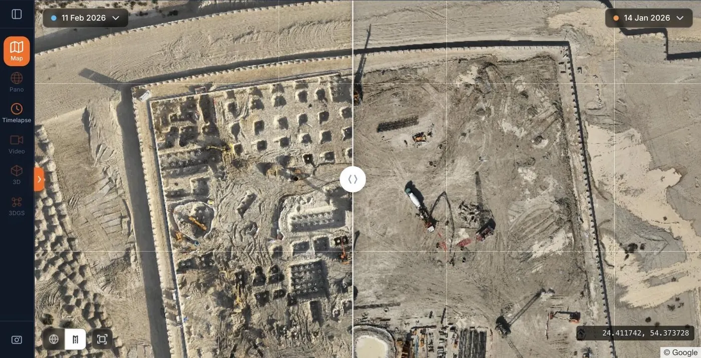
See exactly where the site moved.
Swipe between any two drone surveys on an identical, co-registered view. No manual alignment, no guessing which photo matches which.
- Cut and fill between any two dates
- Stockpile and pit volumes against a boundary base
- Survey-grade capture with ground control
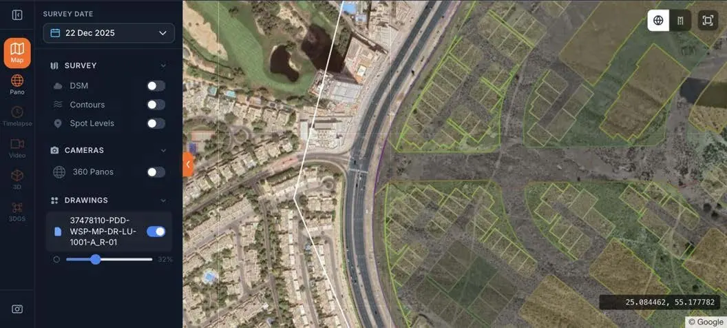
The drawing, laid over what was built.
Bring in DWG/DXF and GeoTIFF overlays and check setting-out and progress against the plan on real survey data.
- DWG/DXF and GeoTIFF overlays
- Masterplans and design surfaces under the as-built
- Checked from a desk, not a site visit
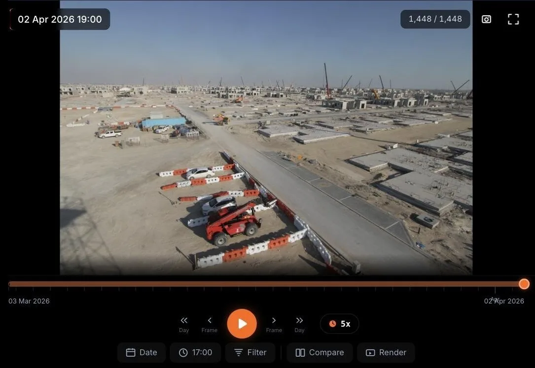
Every camera, every day, one search away.
Fixed cameras capture the site every day. Jump to any date, scrub through months in seconds and pull the frame you need for a report or a claim.
- Filter by time of day for consistent light
- Compare two frames side by side
- Render 4K progress films for the board pack
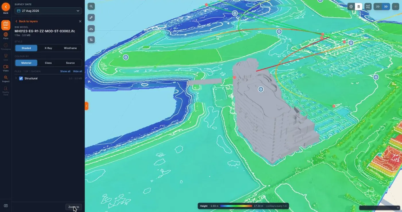
The design, standing in the as-built.
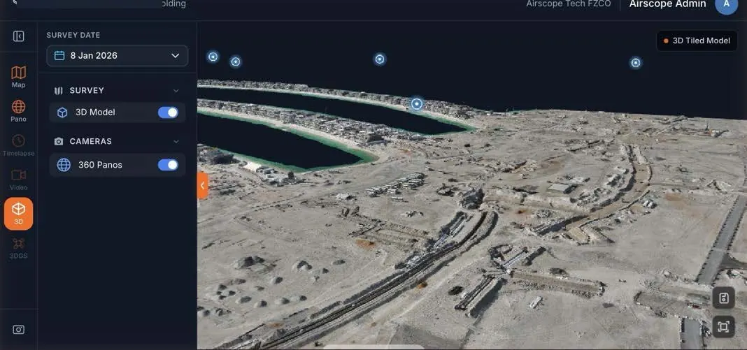
A photoreal model of the site with the point cloud registered to it. Load the IFC and see where the build and the design agree, and where they do not.
- Shaded, x-ray or wireframe views
- Heights and volumes checked on real geometry
- Jump from the model into a 360 panorama
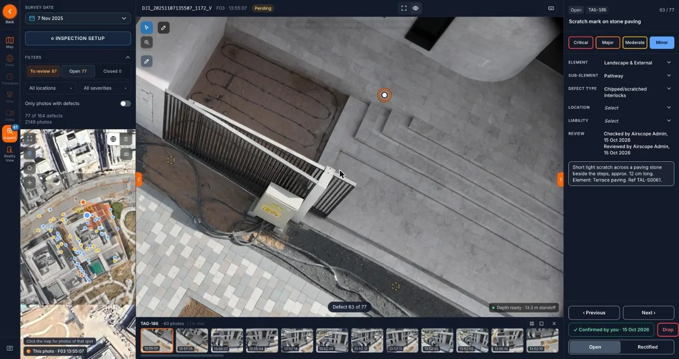
Thousands of photos, turned into a snag list.
AI-assisted detection surfaces defects across a capture. Every snag is pinned to its photo and position, graded and tracked until it is closed.
- Severity grading and status tracking
- Shareable PDF reports for handover
- The same record for contractor and client
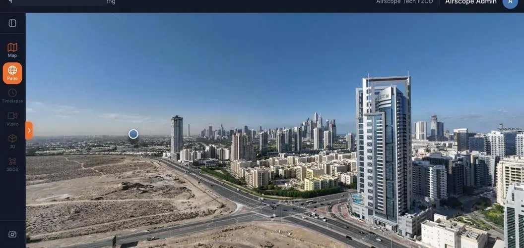
Stand in the middle of the site from anywhere.
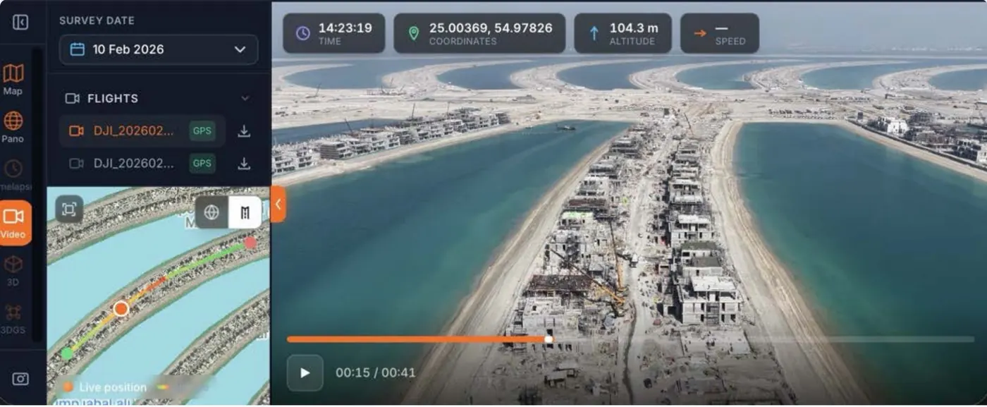
Aerial and ground panoramas pinned to their position on the map, so the same spot can be compared across dates.
- Captured from the air and from the ground
- Pinned to their position on the map
- The same view compared across dates
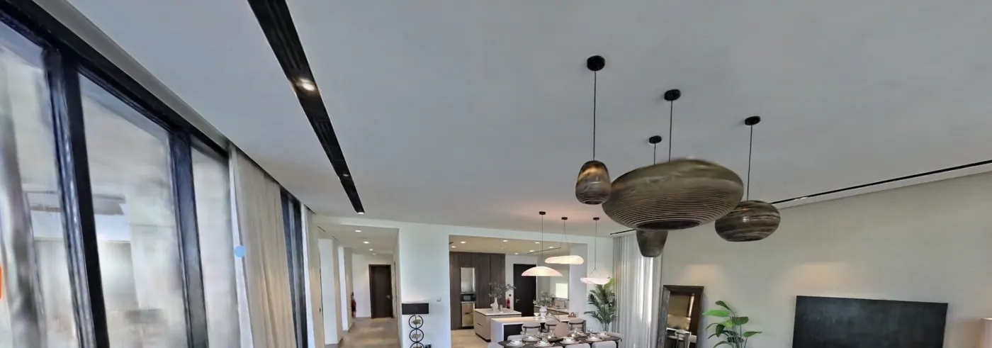
Reality View
Walk the finished building from anywhere
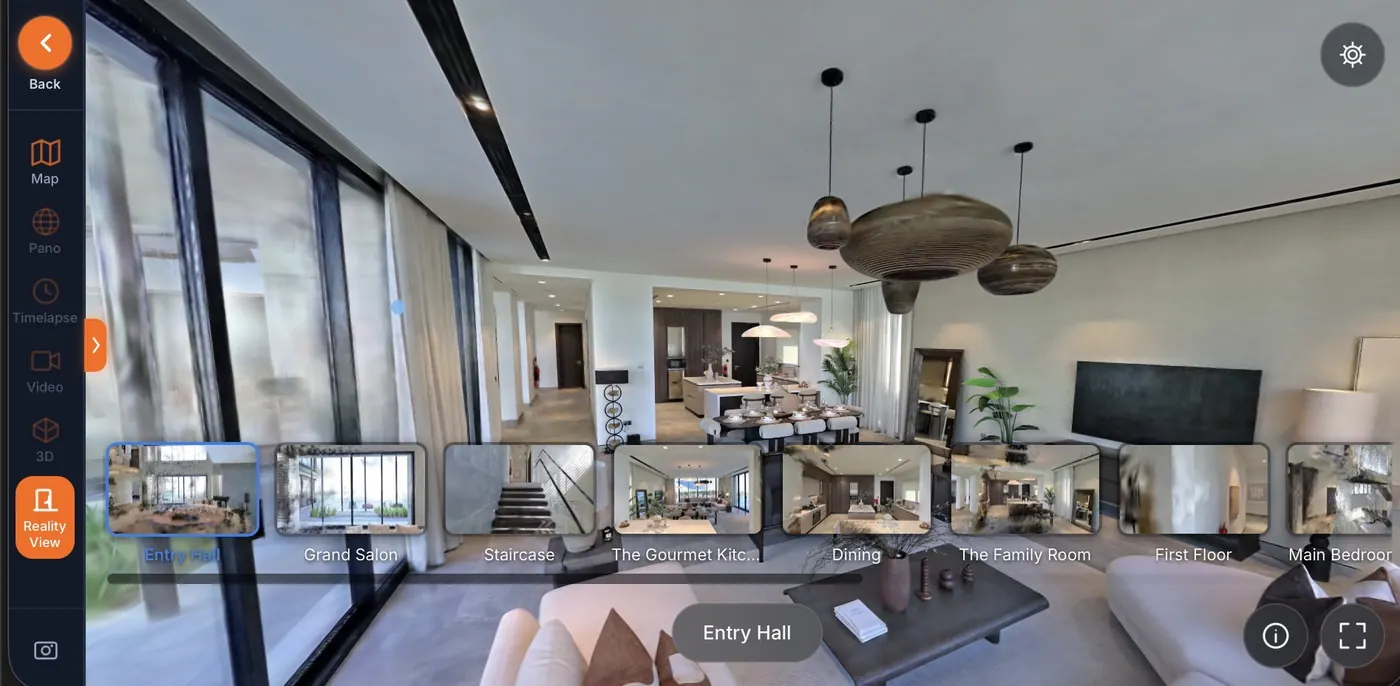
Photoreal Gaussian splats and room-by-room walkthroughs, in the browser, with measurement built in. In production on client sites today, not a roadmap item.
Who it is for
One record for everyone who signs off the build.
Developers and clients
Every site on one screen. Open the latest frame from any camera on your phone, and walk this month's survey without a site visit.
Main contractors
Evidence for valuations, extensions of time and claims: dated, measured, and in the same record the client is looking at.
Consultants and PMCs
Check progress and setting-out against the drawings from your desk, on survey-grade data rather than a site photo.
Your formats, in and out
In
- GeoTIFF orthomosaics and surface models
- DWG/DXF drawings
- LAS/LAZ point clouds
- IFC models and 3D Tiles
- Gaussian splats and 360 panoramas
Out
- MP4 films and 24MP stills
- KML measurements
- GeoTIFF
- Shareable links
- REST API
Handled by people, kept securely
- Checked before it is published. Every dataset is processed and quality-checked by our own survey engineers and GIS specialists before anyone sees it.
- Kept for the contract term. Oracle Cloud storage with automated backups. The archive is still there in year three.
- Access you control. Individual logins with admin, manager and viewer roles, an activity log, and SSO when you need it.
Seen privately, on your own site.
We do not run a public demo. We walk you through the Portal with your own imagery, as soon as the first capture is in.
It is also available white-label: your logo, colours, domain and login page on the front, our cameras, aircraft and engineering behind it. White-labelling can be switched on at any point in the contract.